


Voting District 210521, Kennebec County, Maine
About
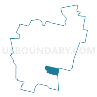
Outline

Summary
| Unique Area Identifier | 591553 |
| Name | Voting District 210521 |
| County | Kennebec County |
| State | Maine |
| Area (square miles) | 19.98 |
| Land Area (square miles) | 19.54 |
| Water Area (square miles) | 0.44 |
| % of Land Area | 97.79 |
| % of Water Area | 2.21 |
| Latitude of the Internal Point | 44.26457710 |
| Longtitude of the Internal Point | -69.72611940 |
Maps


Graphs
Select a template below for downloading or customizing gragh for Voting District 210521, Kennebec County, Maine


Neighbors
Neighoring Voting District (by Name) Neighboring Voting District on the Map
- Voting District 200523, Lincoln County, ME
- Voting District 210531, Kennebec County, ME
- Voting District 210591, Kennebec County, ME
- Voting District 210792, Kennebec County, ME
- Voting District 240561, Kennebec County, ME
Top 10 Neighboring County Subdivision (by Population) Neighboring County Subdivision on the Map
- Augusta city, Kennebec County, ME (19,136)
- Farmingdale town, Kennebec County, ME (2,956)
- Chelsea town, Kennebec County, ME (2,721)
- Pittston town, Kennebec County, ME (2,666)
- Hallowell city, Kennebec County, ME (2,381)
- Whitefield town, Lincoln County, ME (2,300)
- Randolph town, Kennebec County, ME (1,772)
Top 10 Neighboring Place (by Population) Neighboring Place on the Map
- Augusta city, ME (19,136)
- Hallowell city, ME (2,381)
- Farmingdale CDP, ME (1,970)
- Randolph CDP, ME (1,772)
Top 10 Neighboring Unified School District (by Population) Neighboring Unified School District on the Map
- Augusta, ME (19,136)
- Regional School Unit 12, ME (14,838)
- Regional School Unit 02, ME (14,524)
- School Administrative District 11, ME (13,712)
Top 10 Neighboring State Legislative District Lower Chamber (by Population) Neighboring State Legislative District Lower Chamber on the Map
- State House District 79, ME (8,811)
- State House District 53, ME (8,779)
- State House District 52, ME (8,660)
- State House District 56, ME (8,527)
- State House District 59, ME (7,572)
Top 10 Neighboring State Legislative District Upper Chamber (by Population) Neighboring State Legislative District Upper Chamber on the Map
- State Senate District 24, ME (38,252)
- State Senate District 21, ME (38,170)
- State Senate District 20, ME (38,039)
Top 10 Neighboring 111th Congressional District (by Population) Neighboring 111th Congressional District on the Map
Top 10 Neighboring Census Tract (by Population) Neighboring Census Tract on the Map
- Census Tract 106, Kennebec County, ME (7,159)
- Census Tract 108.02, Kennebec County, ME (6,430)
- Census Tract 9751, Lincoln County, ME (5,276)
- Census Tract 105, Kennebec County, ME (4,089)
- Census Tract 107, Kennebec County, ME (2,381)
Top 10 Neighboring 5-Digit ZIP Code Tabulation Area (by Population) Neighboring 5-Digit ZIP Code Tabulation Area on the Map
- 04330, ME (26,086)
- 04345, ME (11,646)
- 04344, ME (2,951)
- 04347, ME (2,355)
- 04353, ME (2,300)
- 04346, ME (1,772)